

-75%

Garmin BlueChart® g3 HD – HXSA009R – Amazon River – microSD™/SD™
Original price was: $122.99.$30.75Current price is: $30.75.
Garmin BlueChart® g3 HD – HXSA009R – Amazon River – microSD™/SD™ Product Description
Experience unparalleled coverage and brilliant detail when you’re on the water with charts that feature integrated Navionics ® data, Auto Guidance technology and more.
Garmin 010C106620 Attributes
- Compatibility: Compatible With Chart Plotters
- Chart Coverage: HXSA009R South America, Amazon River Inland
- Storage: On SD/ Micro-SD Card
Garmin 010C106620 Features & Benefits
- Provides Exceptional Coverage, Clarity And Detail With Coastal Charts That Feature Integrated Garmin And Navionics ® Data
- Auto Guidance Technology Calculates A Route Using Your Desired Depth And Overhead Clearance And Provides A Suggested Path To Follow
- Provides Depth Range Shading For Up To 10 Depth Ranges, Enabling You To View Your Target Depth At A Glance
- Up To 1 Foot Contours Provide A More Accurate Depiction Of The Bottom Structure For Improved Fishing Charts And Navigation In Swamps, Canals And Marinas
- To Aid In Navigation, Shallow Water Shading Allows Map Shading At A User-Defined Depth To Give A Clear Picture Of Shallow Waters
- Limited One Year Consumer Warranty
Garmin 010C106620 Warranties
- garmin-marine-warranty-policy.pdf
BlueChart® g3 HD – HSA009R – Amazon River – microSD™/SD™
Coverage:
Detailed coverage of the Amazon River from Benjamin Constant, Brazil to the Atlantic Ocean, the Madiera River to Porto Velho and portions of the Tapajos and Para Rivers.
Our Advanced Chart Offering
- Derived from official charts and private sources to provide navigational aids, spot soundings, depth contours, tides and currents, and detailed harbors and marinas
- Depth Range Shading for up to 10 depth ranges enables you to view your target depth at a glance
- Up to 1-foot contours provide a more accurate depiction of the bottom structure for improved fishing charts and navigation in swamps, canals and marinas
- Shallow Water Shading feature allows for depth shading at a user-defined level to aid in navigation
Advanced Chart Detail
Detailed charts help the mariner guide their boat in and out of port with confidence.
Depth Range Shading
Displays high-resolution Depth Range Shading for up to 10 depth ranges so you can view your designated target depth.
Detailed Contours
BlueChart g3 HD features 1-foot contours that provide a more accurate depiction of bottom structure for improved fishing charts and enhanced detail in swamps, canals and port plans.
Bluechart G2 HD-Amazon River-microsd/sd coverage: from Benjamin Constant, Brazil to Atlantic Ocean, from Madiera River to Porto’s Amazon River in detail…
Frequently Asked Questions (FAQ) About Garmin BlueChart® g3 HD – HXSA009R – Amazon River – microSD™/SD™
Who is the Garmin?
How to describe Garmin BlueChart® g3 HD – HXSA009R – Amazon River – microSD™/SD™?
What is the compatibility of this product?
Who is the Garmin?
Garmin is a leader in Global Positioning System (GPS) technology and an innovator in consumer electronics. Garmin serves both the aviation and consumer markets. Garmin‘s products are used in flying, boating, driving, hiking, and many other activities. Specifically, Garmin aims to enrich the lives of customers, suppliers, distributors, and employees by providing the very best products that offer superior quality, safety, and operational features at affordable prices.
Related products
-
Electronics
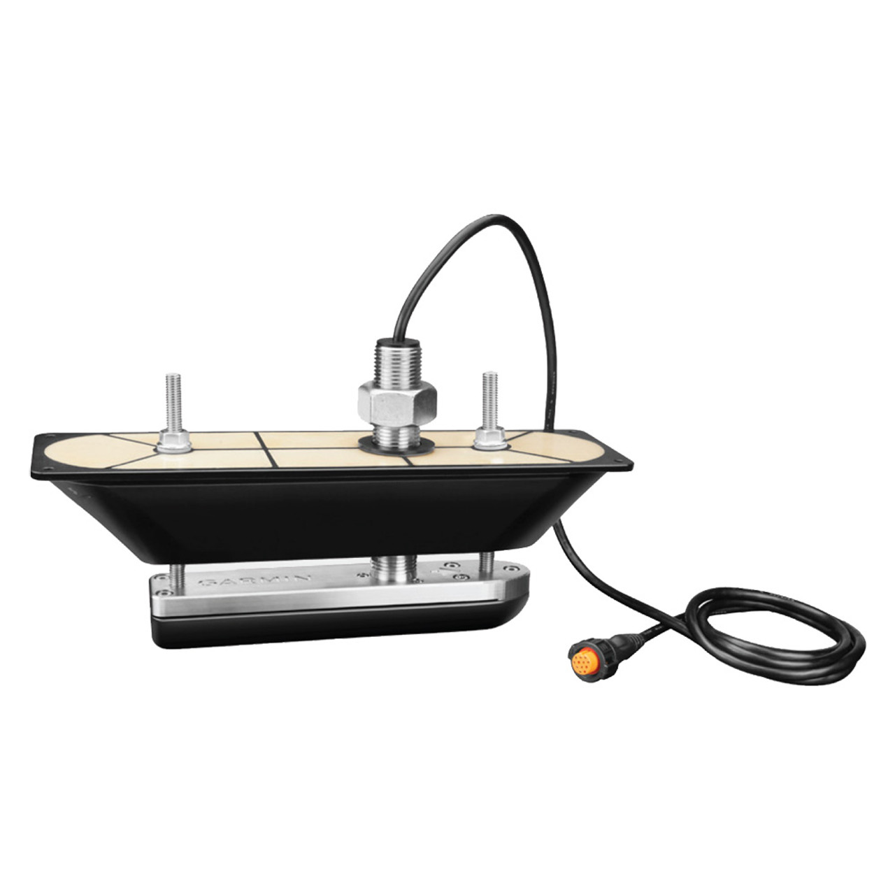
Garmin GT30-TH SS Thru-Hull DownVu/SideVu Scanning Transducer w/Temp f/Hull Deadrises Less Than 5 [010-01961-10]
Original price was: $622.99.$124.60Current price is: $124.60. -
Cartography
Garmin Trailhead Series f/Appalachian Trail – microSD™/SD™
Original price was: $45.99.$18.40Current price is: $18.40. -
Electronics
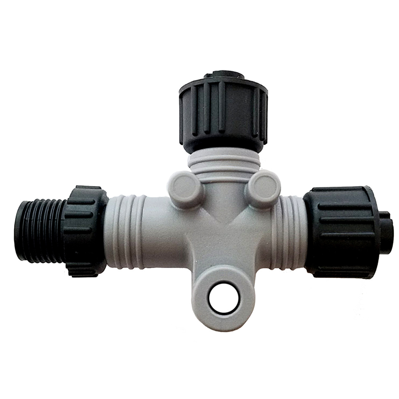
Garmin NMEA 2000 T-Connector – 10-Pack [010-11078-00CASE]
Original price was: $205.99.$51.50Current price is: $51.50. -
Gps - Accessories
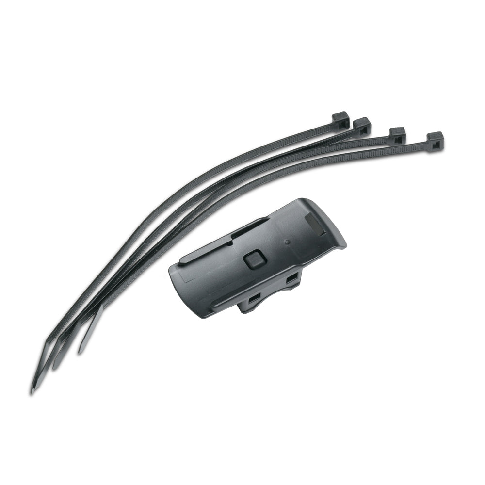
Garmin Bike Mount f/Colorado Series [010-11023-00]
Original price was: $9.99.$4.00Current price is: $4.00. -
Automotive
Garmin USB Power Cable f/Approach® Series, GLO™ & GTU™ 10
Original price was: $29.99.$12.00Current price is: $12.00. -
Transducers
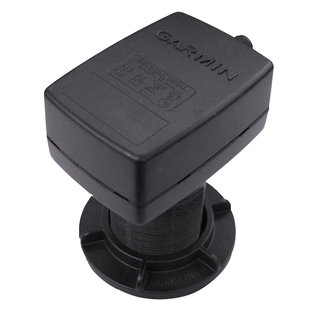
Garmin Intelliducer NMEA 2000 – Thru-Hull – 13-24 Degree Deadrise [010-00701-01]
Original price was: $209.99.$52.50Current price is: $52.50.


![Forespar Lanocote Rust Corrosion Solution – 8 oz. [770007]](https://www.lightingwiring.com/wp-content/uploads/2025/04/73225XL__54912.1638249865.jpg)

Reviews
There are no reviews yet.