

-75%


Garmin BlueChart® g2 Vision® HD – VAE009R – Sin/Mal/Indonesia – microSD™/SD™
Original price was: $284.99.$71.25Current price is: $71.25.
Garmin BlueChart® g2 Vision® HD – VAE009R – Sin/Mal/Indonesia – microSD™/SD™ Product Description
BlueChart ® G3 Vision includes all the reliability, functionality and integrated Garmin and Navionics content of BlueChart g3 while adding even more exceptional features, such as high-resolution relief shading, to help you along your journeys.
Garmin 010C088400 Attributes
- Compatibility: Compatible With Chart Plotters
- Chart Coverage: VAE009R Singapore, Malaysia And Indonesia
- Storage: On SD/ Micro-SD Card
Garmin 010C088400 Features & Benefits
- Derived From Official Charts And Private Sources To Provide Navigational Aids, Spot Soundings, Depth Contours, Tides And Currents, And Detailed Harbors And Marinas
- Garmin Auto Guidance Technology Shows A Suggested Route To A Destination
- Depth Range Shading For Up To 10 Depth Ranges, Enables You To View Your Target Depth At A Glance
- Up To 1 Foot Contours Provide A More Accurate Depiction Of The Bottom Structure For Improved Fishing Charts And Navigation
- Shallow Water Shading Feature Allows For Depth Shading At A User-Defined Level To Aid In Navigation
- Unique 3D Views Like MarinerEye And FishEye Provide Additional Perspective Both Above And Below The Water Line
- High-Resolution Satellite Imagery Of Ports, Marinas, Bridges And Navigational Landmarks For Superior Situational Awareness
- Crystal-Clear Aerial Photography Shows Exceptional Detail Of Many Ports, Harbors And Marinas And Is Ideal When Entering Unfamiliar Ports
- Limited One Year Consumer Warranty
Garmin 010C088400 Warranties
- garmin-marine-warranty-policy.pdf
BlueChart® g2 Vision® HD – VAE009R – Sin/Mal/Indonesia – microSD™/SD™
Coverage:
The southwestern portion of the Malay Peninsula through Singapore and the eastern side of Sumatra Island. Also included are numerous detailed charts covering areas such as Kuantan, Mal., Jakarta, Indo., and Merak, Indo., as well as Christmas, Keeling, and Cocos Islands. General coverage of Java, Celebas, the southern half of Borneo and other surrounding islands east to Timor.
Our Premium Chart Offering
- Derived from official charts and private sources to provide navigational aids, spot soundings, depth contours, tides and currents, and detailed harbors and marinas
- Garmin Auto Guidance technology shows a suggested route to a destination¹
- Depth Range Shading for up to 10 depth ranges enables you to view your target depth at a glance
- Up to 1-foot contours provide a more accurate depiction of the bottom structure for improved fishing charts and navigation
- Shallow Water Shading feature allows for depth shading at a user-defined level to aid in navigation
- Unique 3D views like MarinerEye and FishEye provide additional perspective both above and below the water line
- High-resolution satellite imagery of ports, marinas, bridges and navigational landmarks for superior situational awareness
Auto Guidance¹
Auto Guidance technology quickly calculates a suggested route using your boat’s dimensions and a suggested path to follow.
Depth Range Shading
Displays high-resolution Depth Range Shading for up to 10 depth ranges so you can view your designated target depth.
Detailed Contours
BlueChart g2 Vision HD features 1-foot contours that provide a more accurate depiction of bottom structure for improved fishing charts and enhanced detail in swamps, canals and port plans.
MarinerEye View
Provides a 3-D representation of the ocean floor as seen from below the waterline.
FishEye View
Provides a 3-D representation of the surrounding area both above and below the waterline.
High-resolution Satellite Imagery
High-resolution satellite imagery with navigational charts overlaid gives you a realistic view of your surroundings so you can navigate with a clear moving-chart representation of your boat’s position. It’s our most realistic charting display in a chartplotter.
Aerial Photography
Crystal clear aerial photography shows exceptional detail of many ports, harbors and marinas and is ideal when entering unfamiliar ports.
¹Auto Guidance is for planning purposes only and does not replace safe navigation practices
This product may not be returned to the original point of purchase.Please contact the manufacturer directly with any issues or concerns.
BlueChart g2 Vision provides the same rich detailed charts as BlueChart g2 to help you make the most of your equipment. In addition, g2 Vision also has a growing high…
Frequently Asked Questions (FAQ) About Garmin BlueChart® g2 Vision® HD – VAE009R – Sin/Mal/Indonesia – microSD™/SD™
Who is the Garmin?
How to describe Garmin BlueChart® g2 Vision® HD – VAE009R – Sin/Mal/Indonesia – microSD™/SD™?
What is the compatibility of this product?
Who is the Garmin?
Garmin is a leader in Global Positioning System (GPS) technology and an innovator in consumer electronics. Garmin serves both the aviation and consumer markets. Garmin‘s products are used in flying, boating, driving, hiking, and many other activities. Specifically, Garmin aims to enrich the lives of customers, suppliers, distributors, and employees by providing the very best products that offer superior quality, safety, and operational features at affordable prices.
Related products
-
Nmea Cables & Sensors
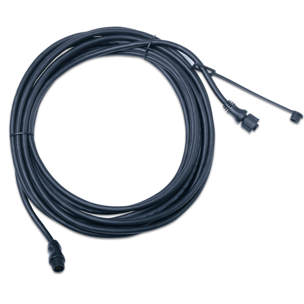
Garmin NMEA 2000 Backbone Cable (6M) [010-11076-01]
Original price was: $34.99.$14.00Current price is: $14.00. -
Nmea Cables & Sensors
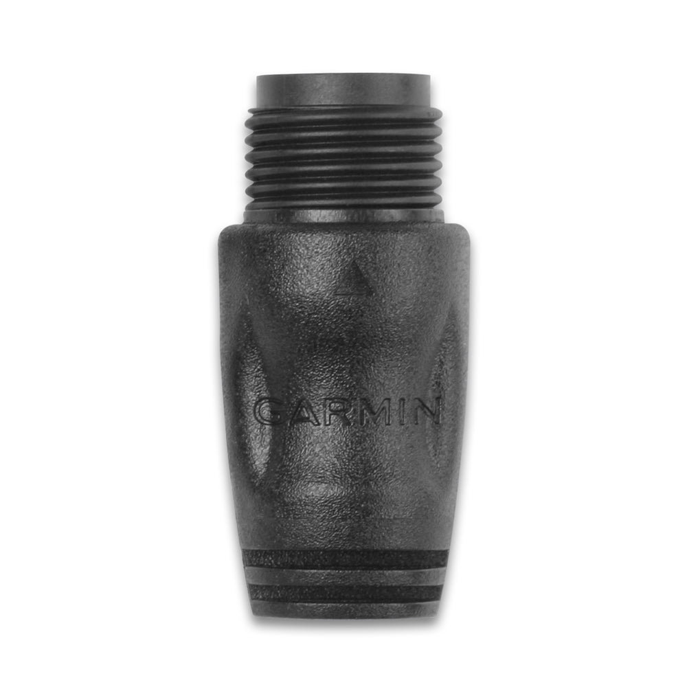
Garmin NMEA 2000 Terminator, Male [010-11080-00]
Original price was: $14.99.$6.00Current price is: $6.00. -
Cartography
Garmin Trailhead Series f/Appalachian Trail – microSD™/SD™
Original price was: $45.99.$18.40Current price is: $18.40. -
Nmea Cables & Sensors
Garmin NMEA 2000 Backbone Cable (10M) [010-11076-02]
Original price was: $39.99.$16.00Current price is: $16.00. -
Nmea Cables & Sensors
Garmin 6′ NMEA 2000 Cable – Right Angle [010-11089-00]
Original price was: $29.99.$12.00Current price is: $12.00. -
Nmea Cables & Sensors
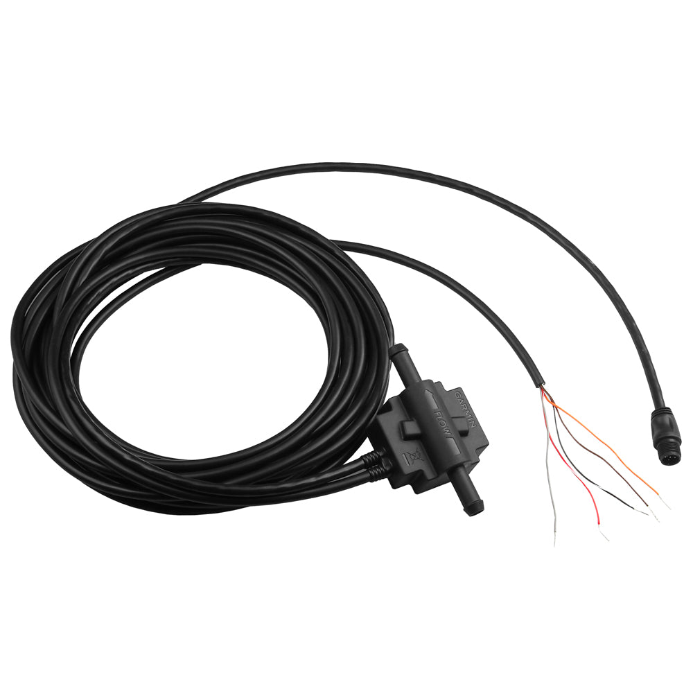
Garmin GFS 10 Fuel Sensor for Gas Engines Only [010-00671-00]
Original price was: $209.99.$52.50Current price is: $52.50.


![Albin Group Marine Standard Electric Toilet Conversion Kit – 12V [07-66-019]](https://www.lightingwiring.com/wp-content/uploads/2025/04/73559XL__66229.1638250121.jpg)
Reviews
There are no reviews yet.